Video
Beta
-
LevelExperienced
-
TrailheadHorseshow Meadows
-
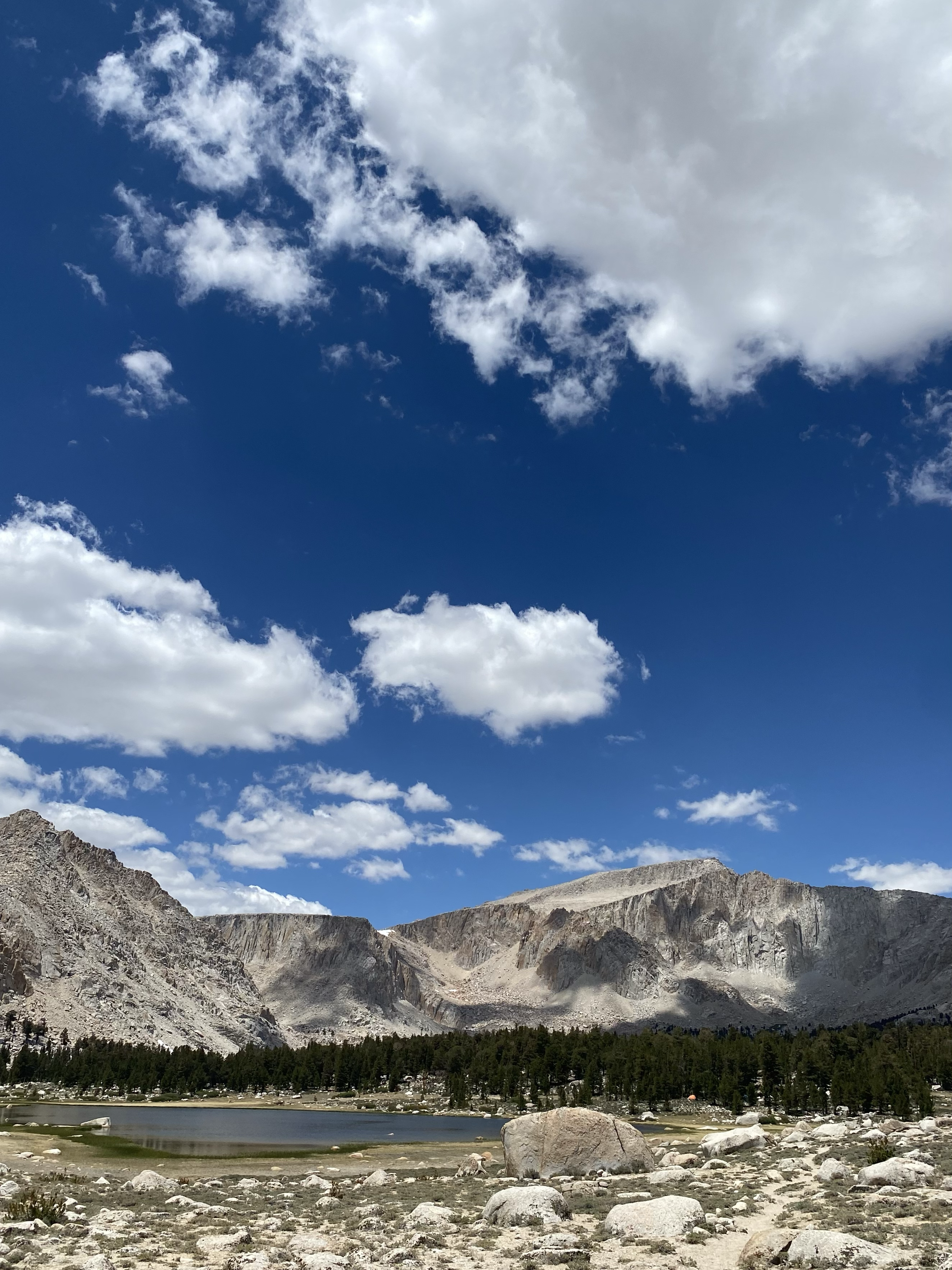
Mileage22
-
Elevation14,032'
-
SeasonsSeasonal
Directions
FR3J+88 Lone Pine, CA, USA
Categories
Land Designation
We would like to use this space to acknowledge the indigenous land upon which we live and play. Payahuunadü is home to the Paiute and Shoshone (Nüümü and Newe) peoples.
Description
HISTORY
Native American Presence
The region around Mt. Langley has a history of Native American habitation. Tribes such as the Paiute and Shoshone have ancestral ties to the area.
Exploration and Naming
The mountain was named after Samuel Pierpont Langley, an American astronomer, physicist, and aeronautics pioneer. Exploration and mapping of the Sierra Nevada region in the 19th century contributed to the understanding of the landscape.
Mining
Like many areas in the Sierra Nevada, the region around Mt. Langley saw mining activity during the California Gold Rush.
GEOLOGY
Granite Formation
The Sierra Nevada is primarily composed of granite, and Mt. Langley is no exception. The granitic rocks formed during the Cretaceous period through the cooling and solidification of molten magma.
Glacial Features
Evidence of past glacial activity can be seen in features like cirques and moraines. Glaciers played a significant role in shaping the high-altitude landscapes.
FLORA & FAUNA
Alpine Vegetation
At higher elevations, expect alpine vegetation such as hardy grasses, mosses, and lichens. Tree line varies, but you may encounter limber pine and foxtail pine.
Wildlife
Fauna includes marmots, pikas, golden eagles, and various species of butterflies. Larger mammals like mule deer and bighorn sheep may be spotted at higher elevations.
Disclaimer
This is not professional advice. Access, parking, difficulty and trail conditions are different from user to user and can change at anytime. Please consult with local land manager and/or local guide services for current information and professional advice.
Understand the effects of high altitude and acclimatize properly to reduce the risk of altitude sickness. Weather conditions can change rapidly. Be prepared for cold temperatures, wind, and potential storms. Check forecasts before the hike. Carry detailed topographic maps and know how to use them. GPS devices can be useful but should not be relied upon solely. Always carry your ten essentials. Accents may require microspikes or crampons depending on season.
Understand the effects of high altitude and acclimatize properly to reduce the risk of altitude sickness. Weather conditions can change rapidly. Be prepared for cold temperatures, wind, and potential storms. Check forecasts before the hike. Carry detailed topographic maps and know how to use them. GPS devices can be useful but should not be relied upon solely. Always carry your ten essentials. Accents may require microspikes or crampons depending on season.
Leave No Trace
Plan Ahead and Prepare
- • Know the regulations and special concerns for the area you'll visit.
- • Prepare for extreme weather, hazards, and emergencies.
- • Schedule your trip to avoid times of high use.
- • Visit in small groups when possible. Consider splitting larger groups into smaller groups.
- • Repackage food to minimize waste.
- • Use a map and compass or GPS to eliminate the use of marking paint, rock cairns, or flagging.
Travel and Camp on Durable Surfaces
- • Durable surfaces include maintained trails and designated campsites, rock, gravel, sand, dry grasses, or snow.
- • Protect riparian areas by camping at least 200 feet from lakes and streams.
- • Good campsites are found, not made. Altering a site is not necessary.
- In popular areas:
- • Concentrate use on existing trails and campsites.
- • Walk single file in the middle of the trail, even when wet or muddy.
- • Keep campsites small. Focus activity in areas where vegetation is absent.
- In pristine areas:
- • Disperse use to prevent the creation of campsites and trails.
- • Avoid places where impacts are just beginning.
Dispose of Waste Properly
- • Pack it in, pack it out. Inspect your campsite, food preparation areas, and rest areas for trash or spilled foods. Pack out all trash, leftover food, and litter.
- • Utilize toilet facilities whenever possible. Otherwise, deposit solid human waste in catholes dug 6 to 8 inches deep, at least 200 feet from water, camp, and trails. Cover and disguise the cathole when finished.
- • Pack out toilet paper and hygiene products.
- • To wash yourself or your dishes, carry water 200 feet away from streams or lakes and use small amounts of biodegradable soap. Scatter strained dishwater.
Leave What You Find
- • Preserve the past: examine, photograph, but do not touch cultural or historic structures and artifacts.
- • Leave rocks, plants, and other natural objects as you find them.
- • Avoid introducing or transporting non-native species.
- • Do not build structures, furniture, or dig trenches.
Minimize Campfire Impacts
- • Campfires can cause lasting impacts to the environment. Use a lightweight stove for cooking and enjoy a candle lantern for light.
- • Where fires are permitted, use established fire rings, fire pans, or mound fires.
- • Keep fires small. Only use down and dead wood from the ground that can be broken by hand.
- • Burn all wood and coals to ash, put out campfires completely, then scatter cool ashes.
Respect Wildlife
- • Observe wildlife from a distance. Do not follow or approach them.
- • Never feed animals. Feeding wildlife damages their health, alters natural behaviors, habituates them to humans, and exposes them to predators and other dangers.
- • Protect wildlife and your food by storing rations and trash securely.
- • Control pets at all times, or leave them at home.
- • Avoid wildlife during sensitive times: mating, nesting, raising young, or winter.
Be Considerate of Other Visitors
- • Respect other visitors and protect the quality of their experience.
- • Be courteous. Yield to other users on the trail.
- • Step to the downhill side of the trail when encountering pack stock.
- • Take breaks and camp away from trails and other visitors.
- • Let nature's sounds prevail. Avoid loud voices and noises.
Add a comment